Transforming Cairo’s Fragmented Edges
By Amira Badran
In the past decade, we have witnessed cities’ planning regulations change along with local political, economic and social disruptions, proving that city planning is directly associated with every other agenda. However, city gridlines and street networks were not laid based on socio-economic diversity, resulting in what we now call ‘fragmented settings’. This notion of fragmented settings or ‘Splintering Urbanism’ is widely occurring and is creating clusters of alienated zones and disputed edges based on economic disparities, political tensions, and cultural differences. Given the current political and social climates, cities are creating ever more disputed edges, separating more neighborhoods, streets, squares and the public realm. A call for an unconventional nation-wide placemaking approach to reclaiming this public space is urgent. Today, we need to actively set guidelines for designers and planners to build cities based on inclusion and mediation.
Applying an edge-based placemaking approach will enable cities to co-create these public yet fragmented settings with the people. This methodical approach, if applied in cities that are still suffering from fragmented settings, will lead to more inclusive, just and sustainable adaptive planning of cities.
I tested this approach in my hometown Cairo - one of the world’s most densely inhabited metropolises on earth and the most important urban agglomeration in Egypt.
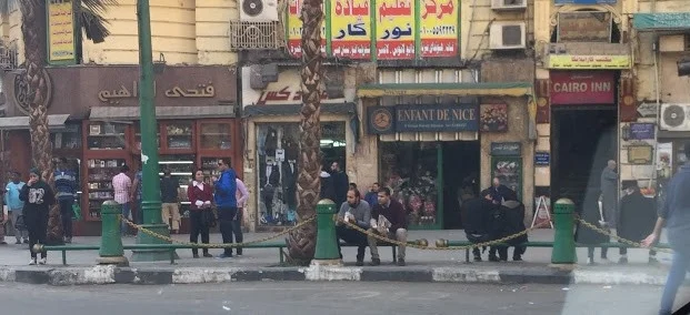
Cairo’s Edges and Fragmented Settings
A man walks by a property wall in Cairo that reads: "No to Military trials against civilians". (Photo: Jenny Gustaffson) - Al Ahram
In Urban Planning and Design dictionaries, edges are defined as urban elements that are either impermeable (disconnecting and creating walls or boundaries) or permeable (seams, connecting, and integrating). Kevin Lynch’s most famous work, The Image of the City claims ‘edges’ are one of the main elements people use to associate with their surroundings. There is a need to understand edges because these are places in which private meets public, indoor meets outdoor and street meets people.
“The edge is the zone you walk along when you’re in town, and these are the frontages you see and experience close up and therefore intensely.”
Cairo’s urban areas are filled with seemingly visible edges:
Edges that define plots of land, abandoned lots, parks and parking structures, and private properties such as gated communities, private clubs, and the like.
Major transportation edges like streets, highways, rail-lines, underpasses and bridges add to the fragmented landscape in Cairo.
Politically-driven edges that have always existed in Egypt have also become more noticeable in the past seven years since the 2011 revolution, specifically around public squares, gathering spaces and municipality buildings. In fact, securitized walls and other formal measures taken by the government to protect public entities and spaces have definitely created numerous fragmented edges in the urban fabric of Cairo.
Socially-driven edges are a result of income-class disparities, varying cultural backgrounds and educational attainments, and most importantly lifestyle differences.
The truth is there is a major income disparity noticeable on-the-ground with some neighborhoods benefitting from more public resources than others. However, there is not much publicly-available data to quantify and forecast the disparity and this in itself presents a crucial planning problem. The following edge-based placemaking approach may therefore serve to highlight disparities through identifying the edges and fragmented settings so that strategic planning can happen in years to come.
A Strategy Framework
From Tracing to Implementing: Studying Edges, Activity Patterns and Needs.
Phase 1 - Tracing and Defining Cairo’s Public Edges
A simple tracing method, with the aid of a figure ground map and a predetermined set of ‘edge-typology criteria’, was used to trace disconnected edges and demarcation lines that have created fragmented settings in Cairo while highlighting the major consequences of such settings on the lives of the people. Of course, tracings will differ from one city to another but the commonality remains that cities are diverse microcosms and the edges reflect this. Tracing public edges says a lot about the context of a city and can help urbanists understand the different factors that affect people’s everyday life.
“In this sense, the boundary is dearly something more than a one-dimensional line for whenever we examine such an edge, we conceptualize an area.”
Photo Caption: The network of lines define public edges traced within the vicinity of the area under study and is connected together through major nodes system identified.
Phase 2 - Engaging all parties
While the first phase in this approach highly depends on the planners’ expertise and technical skills, the second phase requires the involvement of stakeholders who experience the edges daily. When it comes to approaching any public space project with a participatory framework, planners and designers must take the time to carefully understand ownership of the space. The participatory framework, an integral element in sustainable city planning, was made popular by Gehl’s PSPL (Public Space Public Life) research studies and William Holy White’s placemaking strategies.
In the case of Cairo, edges traced in the first phase were found to be typically owned by two or more parties or neighborhoods that were either unrelated or disconnected from one another. In fact, the most common edges traced were those occupied and used by two very different social class neighborhoods who used a common street or park and yet could not seem to agree on how exactly it would be shared. This is when stakeholder participation becomes an especially crucial step in bringing opposing groups together.
Phase 3: Encouraging communication
In order to transform edges that separate groups into ones that connect groups, a dialogue involving the various parties needs to be organized. Bringing different voices in the process of creating a network of accessible public edges is extremely important in order to ensure a real participatory and sustainable system of public space. In this step, the planner should act as the mediator, communicator and facilitator. In Egypt, the centralized governance structure requires that such dialogues involve government representatives and decision makers in addition to the local resident groups.
Phase 4: Selecting suitable strategies
Every edge is then redesigned as an accessible and sustainable public space. In this phase, the various local stakeholders, government representatives, and planners involved work collectively on selecting a suitable strategy to improve the fragmented setting. The table below lists a number of strategies applied in the context of Cairo.
Phase 5: Re-imagining & Implementing
In order for Cairo and many other fragmented cities like it to move towards reclaiming public edges, whole neighborhoods and areas will require physical restructuring. As shown in the table above, regardless of the edges in the city, poor maintenance and abandonment seem to be the default character of these public spaces. Re-imagining the edge completely will be important in creating a new, positive vision for the public space and will be critical in garnering potential donors’ and decision-makers’ support.
Furthering the research
Since the conclusion of my study in Cairo, a few edges have advanced to further stages of analysis led by different local initiatives. In the Mit ‘Uqba neighborhood, for example, a successful approach has been undertaken by the local administration to help redevelop the informal market surrounding the neighborhood’s youth center by transforming it into a formalized institution. The edges along the youth center are being restructured to comfortably accommodate market stalls and other amenities. It seems the edge-based approach to reclaiming public space is proving to be a successful way of creating less disputed and more porous breathing spaces within Cairo and could potentially become an important approach for other similar cities with overpopulated urban fabrics.
(Left) - Before and after market upgrade showing the center's wall and the market edges meet initially creating a conflict. Figure 11 (Right) - Mit 'Uqba Market after stalls addition along the youth center wall. (Photos: TADAMUN Website) (1)
Of course much more work remains to be done. Expanding this edge-based approach at a national level comes with difficulties. It will take a long time to cover a hugely dense area like Cairo, will require more staff and capacity and, most importantly, it will take a lot of effort to ensure government policies and plans allow for this type of public space planning and design to occur. But if we don’t start somewhere, we will never reclaim our rights to our public spaces. In this new year, join Cairo in the shift toward co-creating public spaces. The edge-based placemaking approach can become a tool for your city to transform fragmented settings into connective ones.
More details on Mit ‘Uqba’s redeveloped market can be found online at TADAMUN Initiative: http://www.tadamun.info/?post_type=initiative&p=488&lang=en&lang=en#.Vviqe_krLZs


